Choosing Hotlum-Wintun
We talked about skiing Shasta in 2015 but never got it together. 2016 would be the year. We picked our weekend 3 months in advance. Next step was to figure out the route. Everyone talks about Avalanche Gulch. Some 90% of people summit that way. Information was sparse on the rest, which is one of the reasons I’m writing this. It wasn’t clear how much appropriate space there was for tents, for example. Or how steep the skinning would be going up.
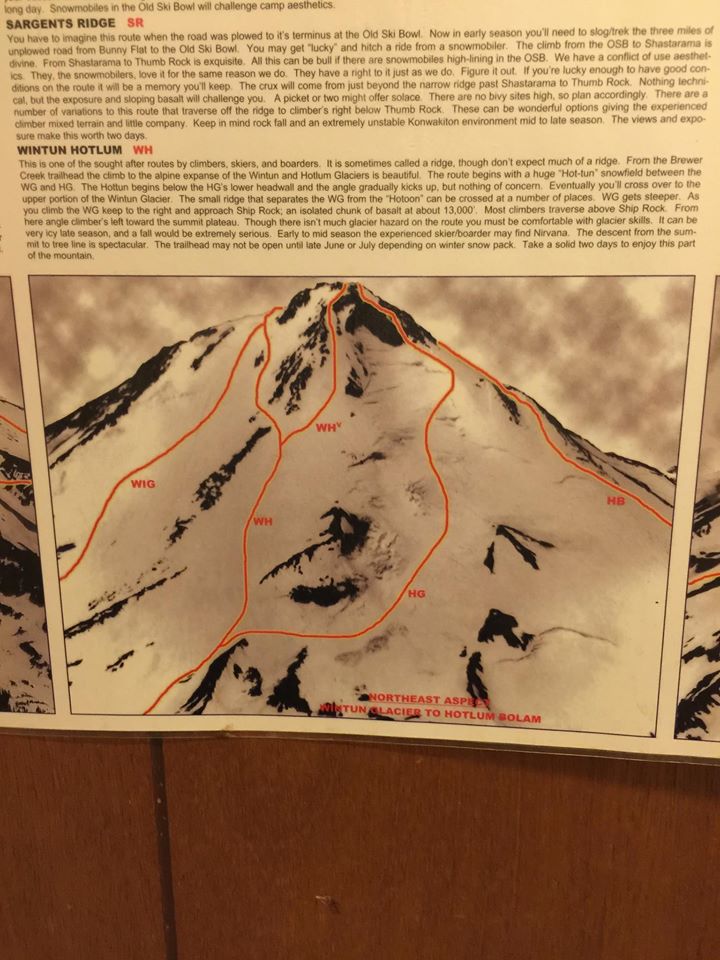
In our research, the Hotlum-Wintum (HW) ridge stuck out. It has a 5 star descent rating at a 10.0 effort level. It’s also the longest ski descent in the US at 7,000+ continuous vertical! HW is steeper, but there are fewer people and less rockfall exposure. So long as we were confident booting up the final section, the all up risk seemed lower.
Training
I was in okay shape from the ski season. I’ve never been an endurance athlete. So I started the following training program to get specific about uphill, rotating workouts 5 days a week: Hiking 1,000 vertical feet (up and then down) with a 43 lbs pack Hill or stair sprints (10x 30-45 seconds of all out effort) 5-7 mile run around SF hitting 1,000 vertical feet Random Crossfit WOD (e.g. squats, burpees, wall ball) Ski, bike, or hike I remember the pain of Mt Whitney from 2013, wishing I had trained more endurance. So this was an easy plan to stick to. I also dialed up my core strength and flexibility.
Diet
I trained on a ketogenic paleo diet, which is normal for me. I dropped 5 lbs of body fat in a couple months. I started supplementing 50-100g of starch (e.g. sweet potato) in the last couple weeks. I decided to avoid ketosis on the mountain. I read about increased risk of altitude sickness and lower cardio efficiency when keto at altitude. Sometime I’ll have to experiment with this. On the mountain I stayed gluten free but ate plenty of dark chocolate and Bob’s potato flakes. Calories and hydration are key, especially at altitude when you don’t feel hungry.
Gear
It was the end of the ski season, so deals were everywhere. By now I had a couple dozen days in my Dynafit Neo boots. They’re an all around “tech” touring boot that has average uphill and downhill performance. I own backcountry powder skis with tech bindings but knew that would slow me down due to weight and width. So I pulled the trigger on the Volkl VTA 88 in a 170 length. They had decent reviews but the best part was the 1 kilo weight per ski.
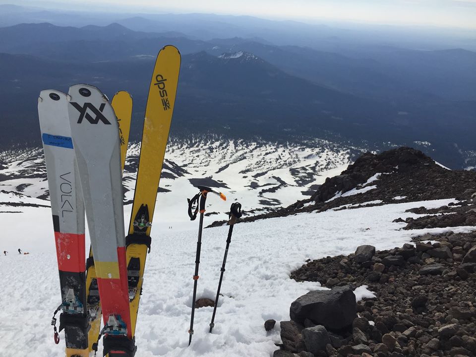
I paired the Volkls with the Dynafit Speed Turn bindings, a super simple setup. No brake just a leash. I put this together and managed to get 4 days on them at Squaw Valley in May. They’re so light and fun in the spring snow. I wanted to use the matching skins for the Volkls but couldn’t find them anywhere online. So Tahoe Sports Hub set me up with the G3 Alpinist LT which are allegedly better for wet snow (aka the west coast). I put together that whole setup (boots, skis, bindings, skins) for just about a grand, brand new. I had some basic Black Diamond Contact bindings but don’t love them. They’re heavy steel and just have a strap mount. CAMP USA caught my attention with the XLC 390 bindings. These are aluminum and have an automatic mount which is easier to mount. They’re also lighter and have a tight fit on a ski boot toe and heal. I paired that with the aluminum CAMP Corsa Nanotech 50cm ice axe. This was much lighter and more functional for steep climbing than my classic 60cm Grivel G1.
The trip
Day 0: the drive
Three of us work together and left from our office in Menlo Park at 3:30pm. With plenty of Bay Area traffic and a Chipotle stop, we got to Redding around 9pm. Some quick gear sorting and a Safeway run for snacks, and we were out cold in the Best Western at 10:30pm.
Day 1 prep
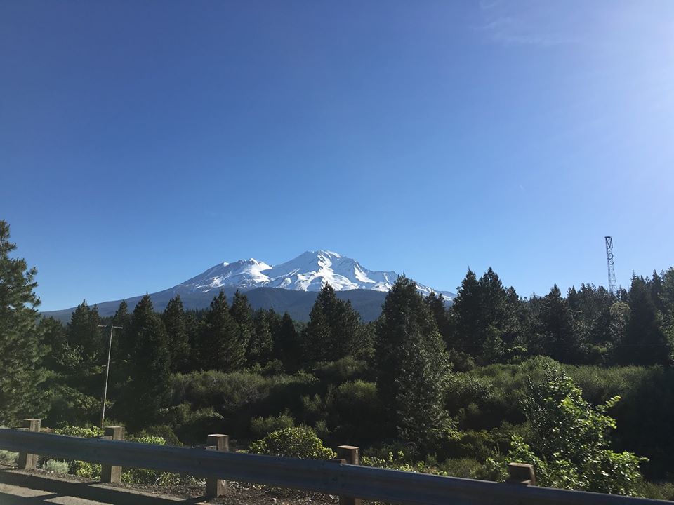
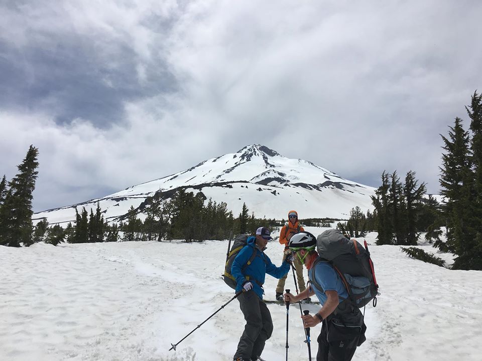
We left Redding at 7am. The drive to Mt Shasta was gorgeous. You could see the peak from 60 miles away. The Fifth Season is the center of Mount Shasta town. It’s the gear shop everyone rents from. We met our buddies from Seattle there to get every last piece of gear we needed, including our summit permits. After organizing our packs on the sidewalk, we took off for Brewer Creek trailhead (which leads to Hotlum-Wintun). The drive was long and dusty. After an hour, we hit patches of snow too large to drive over.

So we pulled off the road about a mile before the trailhead. Elevation was around 6,700 ft (actual trailhead is over 7,000 ft). Luckily, there was a snowy, shaded gully that would allow us to start skinning immediately. It was at least 70 degrees, so shorts and t-shirts were the outfit of choice. My farmer’s tan would later regret this.
Beginning
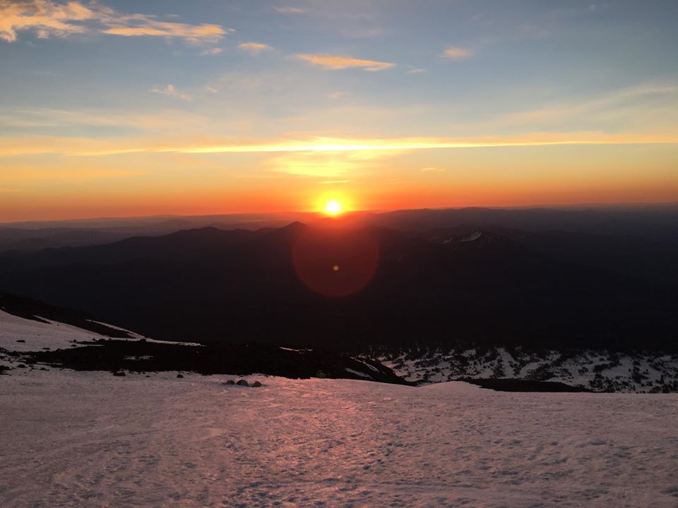
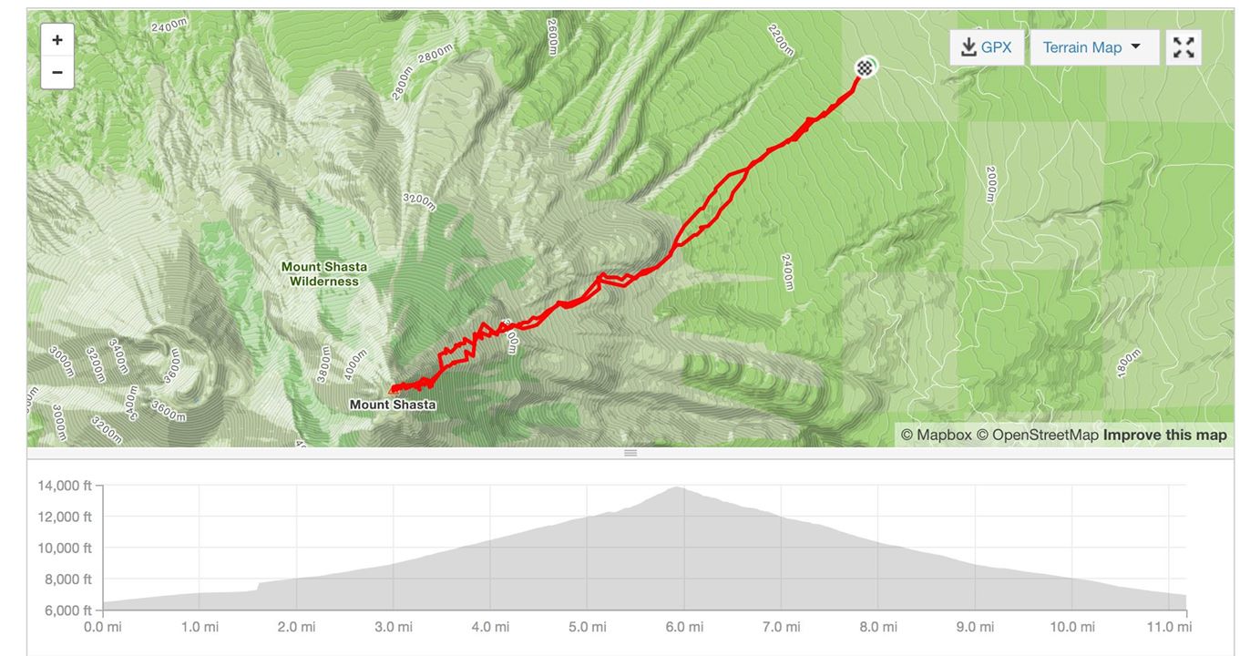
We started skinning up at 11:30am. Maintaining a pace that wouldn’t overheat was key. I kept putting snow in my hat and down the back of my shirt to cool myself off. We were northeast of the Brewer Creek trail so we had to cut over quite a bit. Hearing horror stories of losing the path back and having to bushwhack, we used GPS to track our path. The climbing was nice. Not too steep, but the snow was getting slushy in the heat. We stopped for lunch a couple hours later on the edge of the treeline near the actual Brewer Creek. The going got tough around 3pm when we hit some actual incline. We took a nice break on some rocks before making our final push on a steeper snowfield. We got to base camp just before 5pm. It was somewhere around 10,300 ft with amazing views of the hills to the east. Prior hikers had built a mini snow wall that offered us some protection. We setup our 3 tents, boiled some snow, and ate our dinners. Lights were out by 8pm even though the sun stayed up much longer.
It felt so good to lay down. Coming from sea level, I worried about sleeping at 10k feet without any acclimatization. I made sure to drink tons of water during the day which helped balance the effects. It still felt like I was short of breath most of the night. My elbows and knees felt like they were on fire from sunburn.
Day 2 summit
4am wakeup. Sunlight was already refracting over the eastern hills. Overnight temps stayed in the 40’s. This was already one of the warmest days of the year.
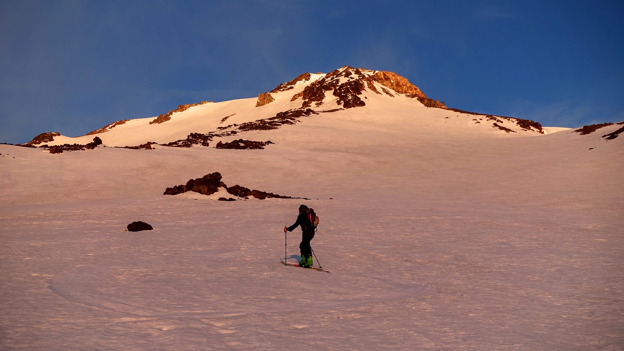
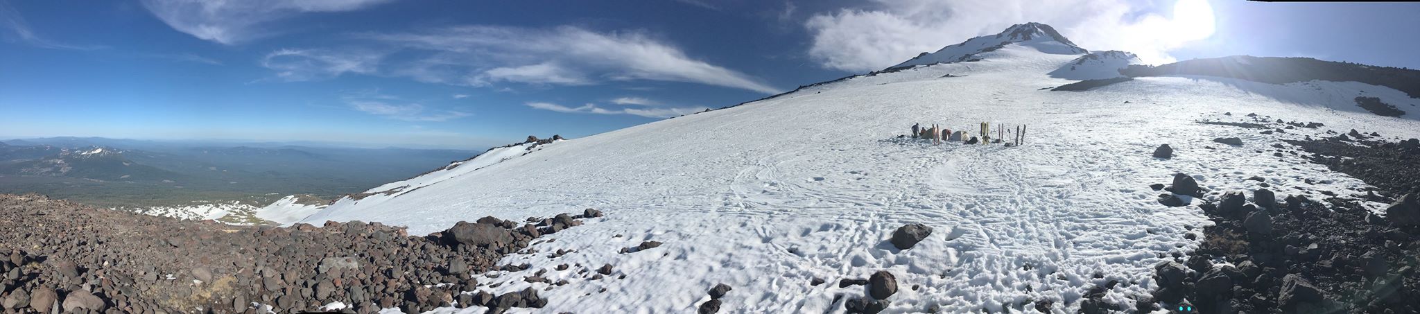
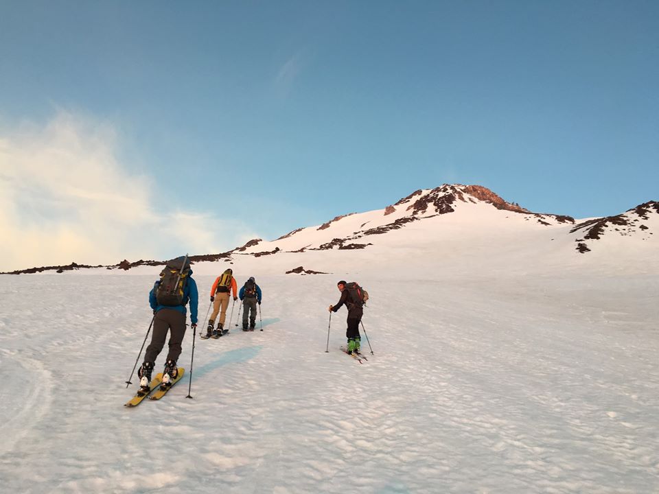
After a warm breakfast and tea, we were climbing just as the sun began to peak over the horizon at 5:20am. We knew today would be firmer and steeper snow. All but one of us had ski crampons. Those things helped a ton. The snowfield was long and wide. The slope was probably 30 degrees. We zig zagged until hitting Lunch Rocks (12,800 feet) around 9am.
Two in our group were struggling with the skin track (one cramponless skier and one splitboarder). So they decided to hike the ridge that separates the Hotlum and Wintun glaciers. It turned out to be 1,000 ft of loose rock and gravel in high winds. Not fun. We all met at Lunch Rock. Once you cross this area to the south, you’re committed to booting up; it’s too steep to skin. Though not too steep to ski down. The wind was picking up, which is cause for concern. Too much wind can catch you off guard and cause you to lose balance. Losing balance could mean falling. Falling could mean losing control and descending thousands of feet, fast.
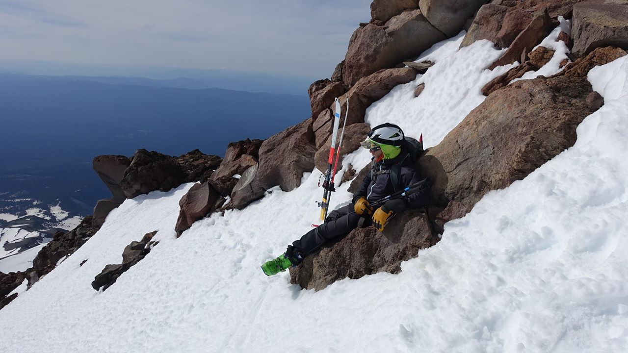
We snacked, discussed, and felt that the combination of firm but pliable snowpack and moderate wind was not unsafe. So we put our skis on our packs, attached our crampons to our ski touring boots, grabbed our ice axes and began our final push. I was nervous about the new XLC 390 crampons, but they were perfect. I’m glad I installed the anti-balling plates on them.
Final push
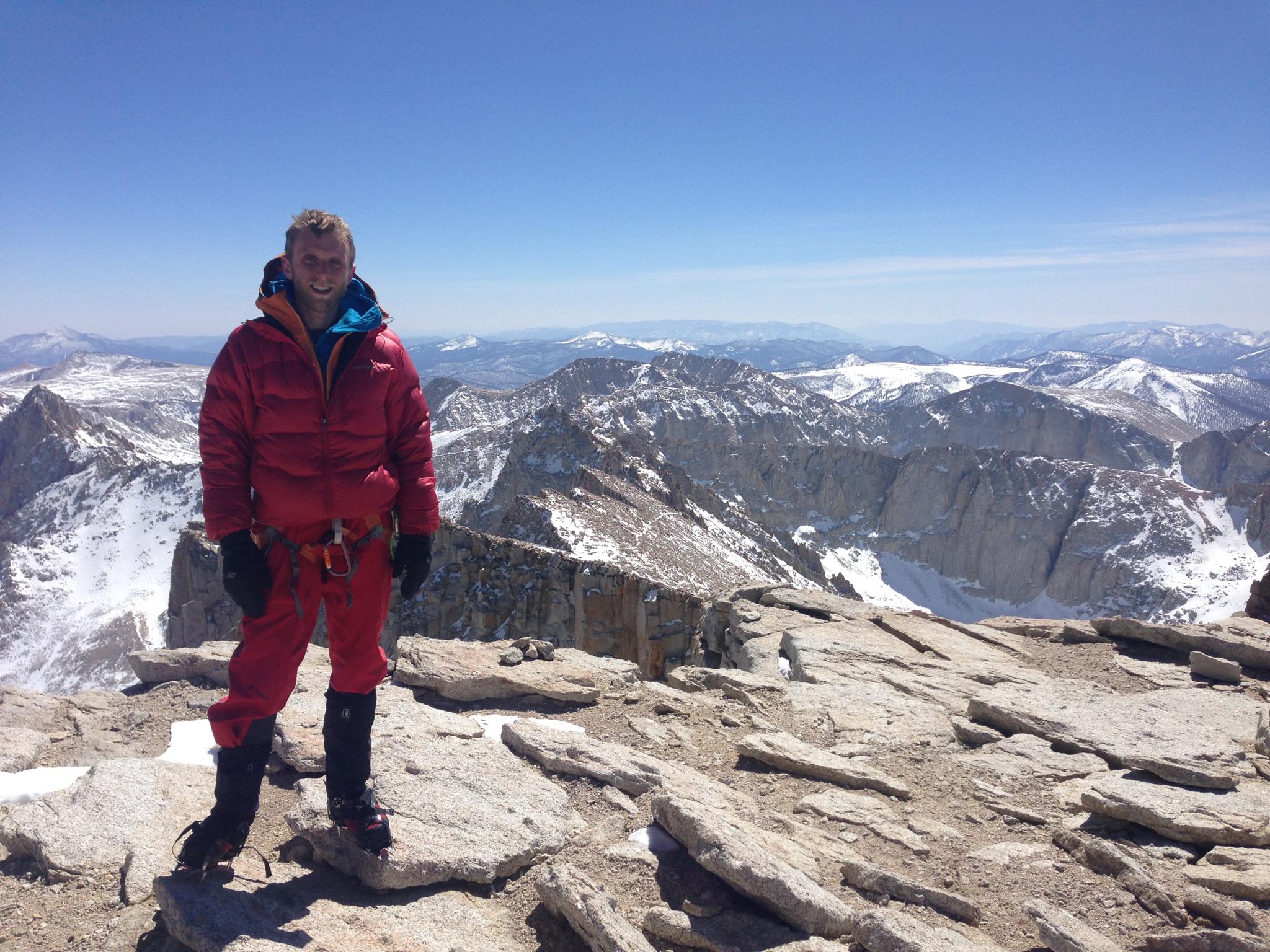
The climb now started to remind me of Mt. Whitney. We summited via the Mountaineers Route in March 2013. It was a similar neverending steep slope.
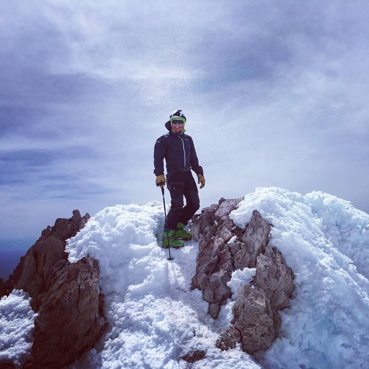
But this snow was much firmer (we did Whitney in the afternoon slush), and there was a solid book track. That allowed us to walk as if it were a staircase. We “free solo’d”, self-belaying with our ice axes. No ropes or harnesses as that would have increased risk. Straight up we went to the summit with one break on a rock outcrop. We hit the summit at 11am sharp. Less than 6 hours after leaving camp.
The Summit
There wasn’t some grandiose crux or class 5 move to get to the summit. It just kind of got less steep and you hit a ridge with a bunch of people on it. But man it felt great to be finished with the climb. I definitely had more gas in the tank, which I needed for the downhill.
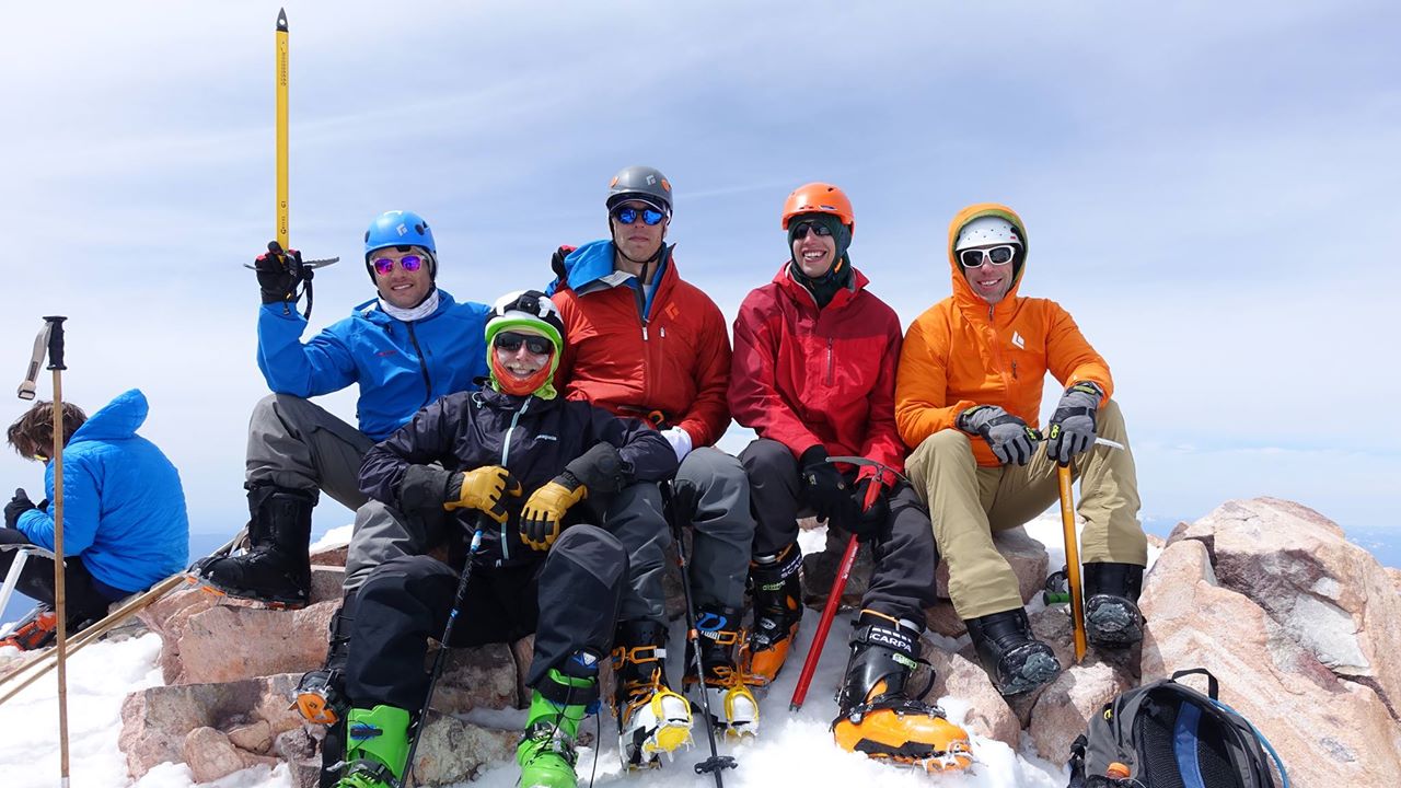
It was windy on top, 40+ mph. And there were a ton of people. 90% coming from Avalanche Gulch (a much more popular and easier to access route). We hung around and took photos for 15 mins before transitioning to downhill skiing. I regretted not taking the skins off my skis 1,500 feet below in mild wind. They could have sailed to the Pacific 60 miles away. Lesson learned. I didn’t do a great job putting my skins away or my boots in ski mode (liner tongues were off) but it was good enough for confident skiing.
Downhill
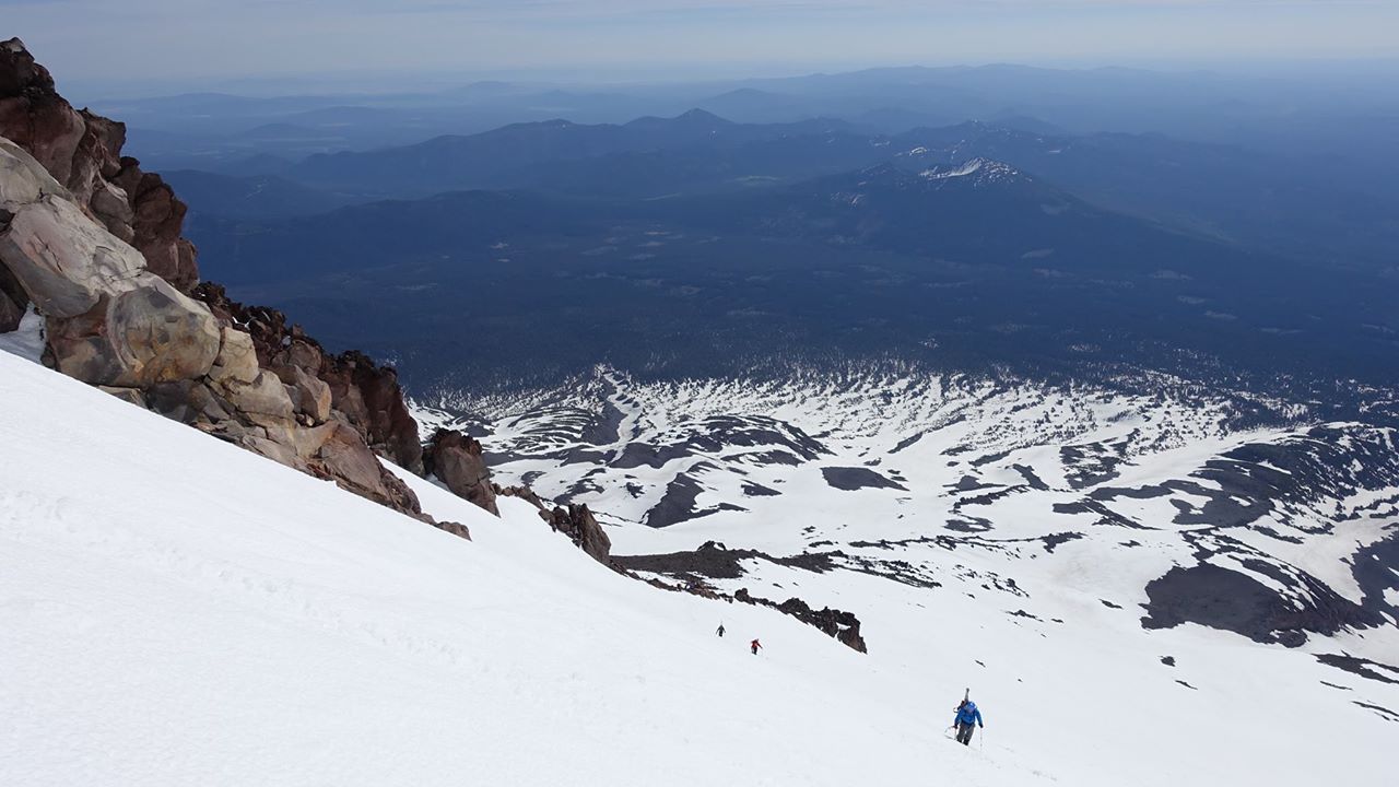
Staring down from the 14,000+ foot summit ridge was pretty unreal. A 40+ degree sustained pitch for thousands of feet was a lot to swallow. I haven’t done much double black skiing. If I did, it meant ski patrol was nearby or it was a short section. Luckily the wind died down after descending some 50 feet. The snow became a lot softer too, allowing for mushy turns that took off speed. The surface was nice and consistent, a good change from the moguled and tracked out resorts! We decided to lock the toe pieces on our Dynafit bindings as we considered this no fall territory. This implied conservative jump turns, taking off speed each time. I decided to ski with poles instead of trying to hold an ice axe for self-arresting. I read too many bad stories about it going all wrong.
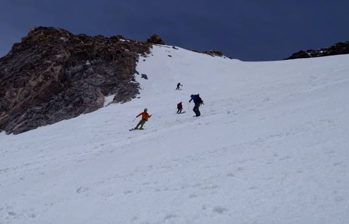
We got down to Lunch Rock fairly easily, taking off our skis to hop a few boulders. Then a nice traverse onto the snowfield we had skinned up. This was the best part. 2,000+ feet of 30 degree slope. I took out my loaned 360 camera, and we got some fun video of us all going down together. It was now getting hot. I still had my down jacket on from the summit but that quickly came off and we were back down to a single layer.
We got back to camp and discovered that our tents weren’t where we left them. Our attempted deadman anchors had melted and no longer held our weightless tents in place. We recovered everything except for a few tents stakes.
It now felt about 80 degrees outside. We skied the 3,500 foot run to the car. Wearing a heavy pack while skiing was different. The snow started to get sticky until we hit the treeline. Thank god for trees. The snow was much better here and super fun to make some tight, banked turns. Our GPS kept us on track; getting lost would have sucked. We got to the car around 1pm. After a rest, snack, and drink, we took off for the town to return gear and have a late lunch.
Thoughts
My first reaction was, “this wasn’t nearly as tough as Whitney”. That’s due to a few things: Warmer weather Better fitness Skis - faster uphill and much faster downhill Better timing - early morning uphill on Shasta vs. afternoon slush on Whitney I’d love to do Shasta again and would do it the exact same way. I’d like to try Avy Gulch just to see what everyone else experienced. There are some variations on HW but nothing that different. An option we discussed was to spend an extra day and just tour the snowfield above camp. It looked like there’s a decent way to get up to 13k feet and ski 3,000 vertical to camp from there. What’s next? Maybe Rainier, peaks in Europe, South America, or maybe even the Himalaya?